Global Energy GIS Data for the Energy Industry
For many years, offering the most accurate and most complete energy GIS Data for the United States has made Hart Energy’s Rextag the best known GIS Data provider for the Energy Industry. And after years of research and development we have expanded our products. We now offer the Global GIS Data Coverage, a seamless expansion to our North American dataset.
At Hart Energy Mapping, we collect information on energy infrastructure from hundreds of sources with hundreds of methodologies from all over the world. We then aggregate all that information into the most comprehensive energy GIS Database—The Rextag Energy GIS Data, which we license to third party companies for their own analysis, research and mapping of energy infrastructure.
Our licensing approach allows our users to target their specific needs; they can obtain the entire global data set or focus on specific regions and/or commodities. Furthermore, we provide a geographic breakdown of our North American dataset, dividing it into 3 zones, each of which can be licensed separately, creating a licensing system that is more cost sensible.
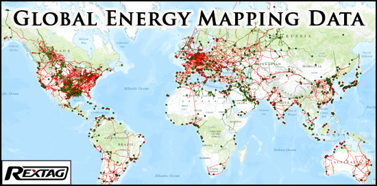
Our Global GIS Data covers more than two million miles (3.2 Million Km)of oil and gas pipelines, and thousands of energy facilities, such as refineries, LNG terminal, gas processing plants, terminal, and much more.

Our GIS Data’s dependability is achieved through a careful data-normalization process, always keeping our customers’ satisfaction in mind. We take several fundamental verification measures to develop data reliability, which include data analysis, querying, graphical representation, and more. Plus, our research team is constantly mining industry private and government agencies for acquisition, purchases, investment and other general press releases to constantly update our Digital GIS Energy Datasets. The data is provided in the most common format: ESRI Shapefile (*.shp) projected at the WGS 83 standard, which can be easily imported into any other GIS system besides ESRI's ArcGIS.

Keeping in mind budgetary constraints small and medium size companies face, Hart Energy designed the most affordable licensing plan in the market.
Thus, Hart Energy's Rextag Data is not only the most affordable alternative to high-priced GIS energy data in the market; not only the most generous licensed product; but it also offers invaluable quality and quantity of information. In addition to the geographic breakdown into zones, and to ensure affordability to our users, our GIS Datasets are broken down as follows:
- Oil & Gas Transportation & Processing (OGTP) Data Set:
- Natural Gas & Misc.
- Natural Gas Pipelines and Facilities
- Misc. Gasses Pipelines (CO2, Ammonia, Hydrogen, Etc..)(U.S. ONLY)
- Crude Oil and Liquids
- Crude Oil Pipelines and Facilities
- Refined Products Pipelines and Facilities
- Other Liquids (NGL/LPG/HVL) Pipelines and Facilities
- Rail Transport (Crude, Refined, Etc) (Available in North America ONLY)
- Other Energy Datasets
Technical Specifications: Our data is provided in ESRI Shapefile (*.shp) in a NAD 83 projection, digitized at different scales depending on area and/or pipeline.
Disclaimer: Rextag Strategies is not responsible or liable for any use or reliance on this data. Rextag Strategies has made a great effort to ensure the quality of the data represented here, however omissions and errors may exist. We welcome corrections and revisions to improve the accuracy for future editions.
Data Security: In an effort to ensure the security of our nation’s energy infrastructure, Rextag Strategies reserves the right to refuse service to companies or individuals with no active involvement in the energy market. A preliminary background check will be performed prior to any release of data at the sole discretion of Rextag Strategies.


